August 25, 2026

6 minutes read

6 minutes read

By

Running routes at Engel Obertal

Four loops between 2.7 and 8.2 kilometres. An easy morning run at one end, a demanding forest loop at the other.

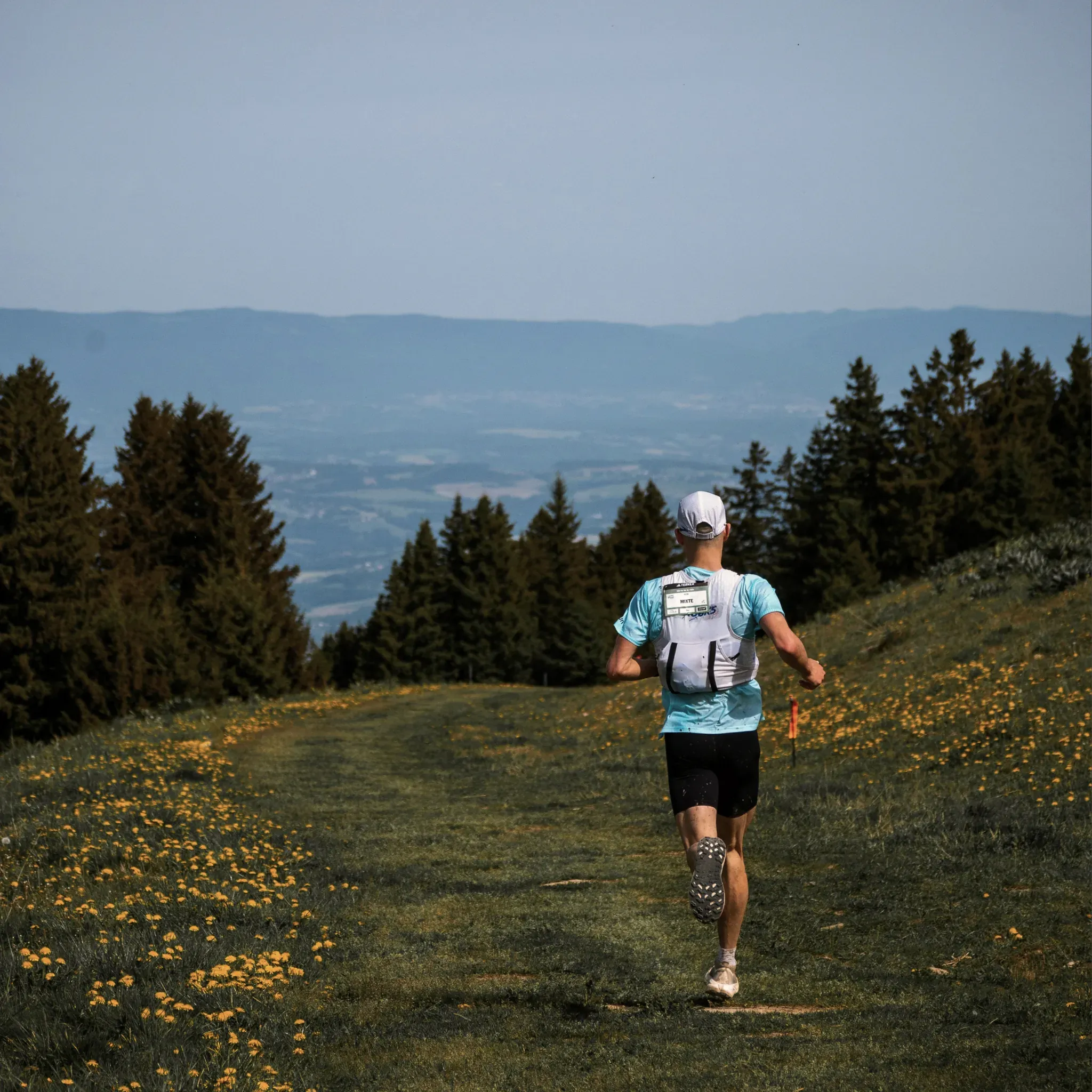
Läufer mit Trinkweste joggt über eine blühende Bergwiese am Waldrand.

The Black Forest does not belong to hikers alone. Keen runners will find plenty around Obertal too, those who run for pleasure as much as those in serious training. Every run is an encounter with nature, over hill and valley, past streams and ponds, through meadows and woodland.

Four routes between 2.7 and 8.2 kilometres start right at the Hotel Engel, arranged from easy to demanding, each with a map and elevation profile. The times given assume a leisurely pace of seven kilometres an hour.

Engel-Runde, the gentle introduction

2.7 kilometres · easy · 28 metres of ascent · about 25 minutes

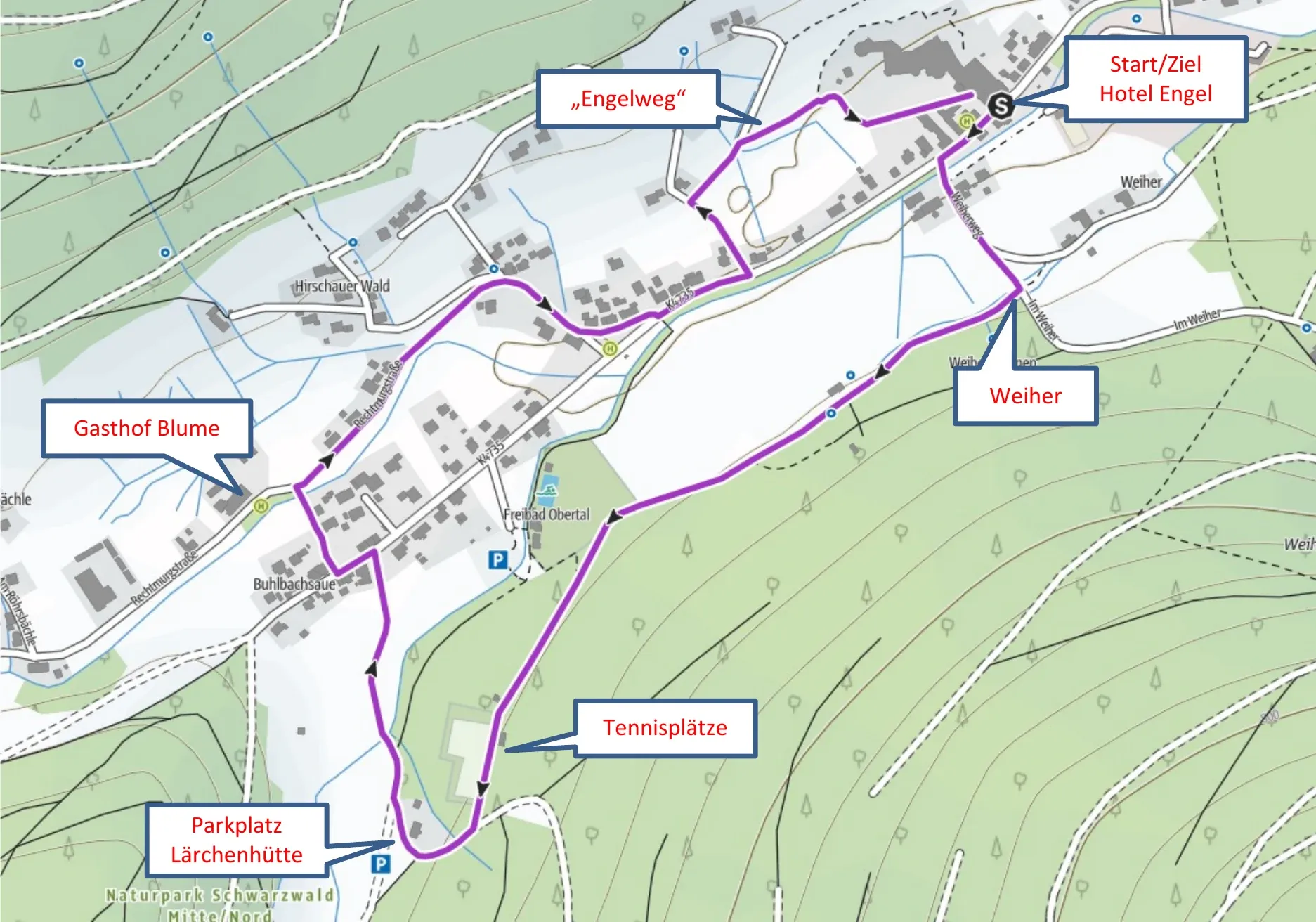
The short loop for morning or evening. Cross the bridge and head uphill to the Weiher signpost, then turn right onto the tarmac footpath and keep straight on past the tennis courts to the fork by the Lärchenhütte.

There, go halfway round the hut, over the bridge and out of the Buhlbach valley. At Vorderer Hirschauerwald turn left into the Engelweg, then follow the gravel track past the sunbathing lawn and you are soon back in front of the hotel.

Laufstreckenkarte der Engel-Runde ab Hotel Engel Obertal mit Route über Engelweg, Gasthof Blume, Tennisplätze und Parkplatz Lärchenhütte.

The Engel-Runde, 2.7 kilometres for a run before breakfast.
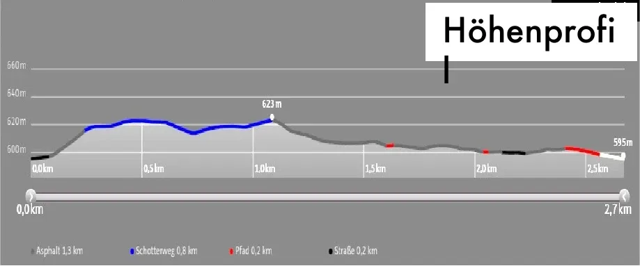
Höhenprofil der Laufstrecke Engel-Runde: 2,7 km, 28 Höhenmeter.

Elevation profile of the Engel-Runde, just 28 metres of ascent.
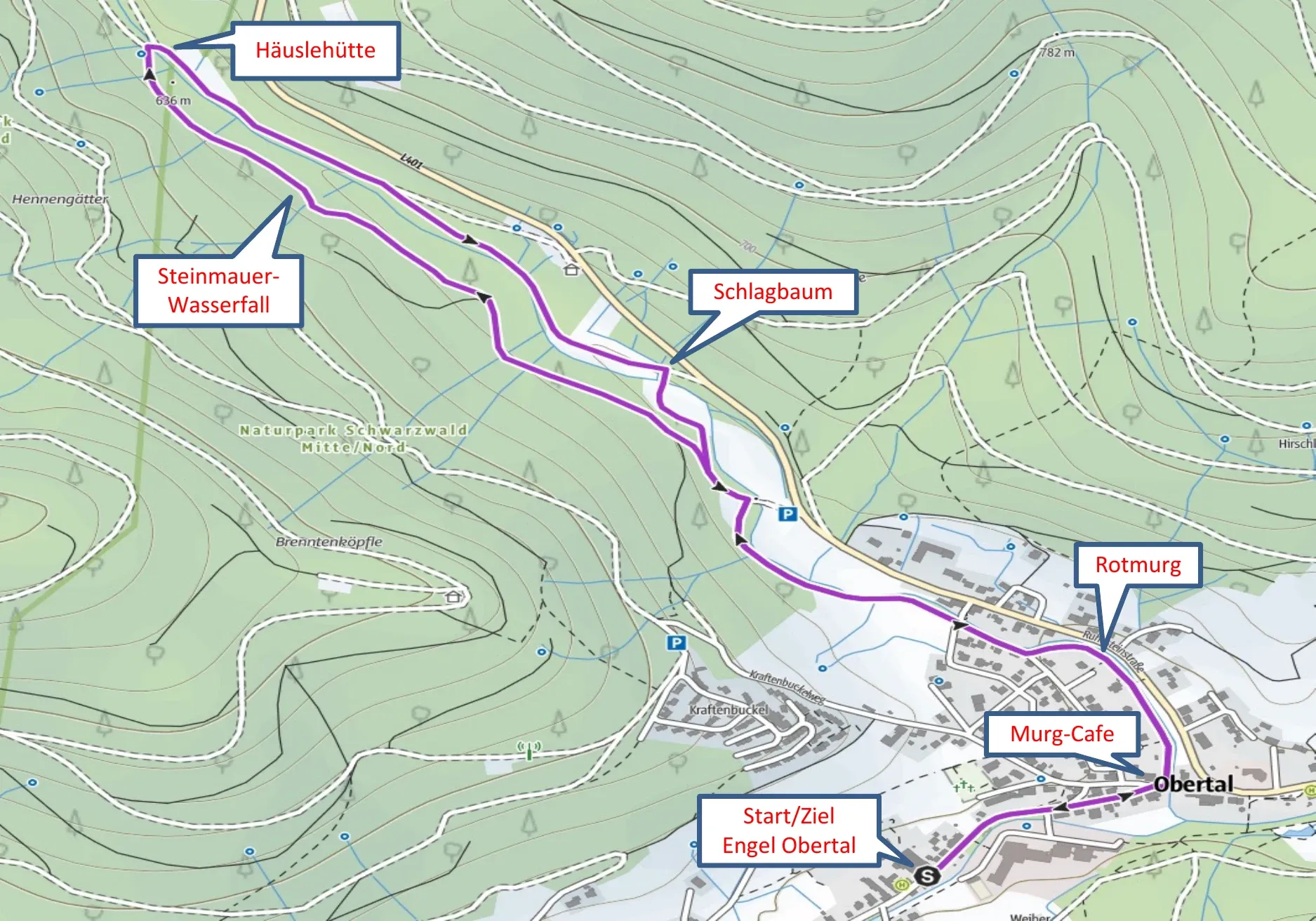
Häusle-Rundweg, along the water

5.1 kilometres · easy · 67 metres of ascent · about 50 minutes

From the hotel, turn left towards the Ruhesteinstraße and continue to the Murg-Café, where a footpath branches off before the Murg bridge. On the left bank of the Rotmurg you run gently uphill, past a stone wall with a waterfall just short of the highest point.

The way back crosses the bridge at the Häuslehütte and follows the tarmac road along the Rotmurg. Turn right at the red and white barrier, cross the wooden bridge and take the meadow path back onto the gravel track of the outward leg, then continue through the residential streets to the Murg-Café and the Engel.

Laufstreckenkarte des Häusle-Rundwegs ab Engel Obertal mit Route entlang der Rotmurg über Murg-Café, Steinmauer-Wasserfall und Häuslehütte.

The Häusle-Rundweg follows the Rotmurg along both of its banks.
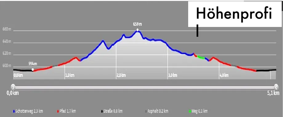
Höhenprofil der Laufstrecke Häusle-Rundweg: 5,1 km, 67 Höhenmeter.

Elevation profile of the Häusle-Rundweg, 67 metres of ascent at a steady gradient.

“Fresh Black Forest air is the best training partner, and the sauna afterwards the best recovery.”
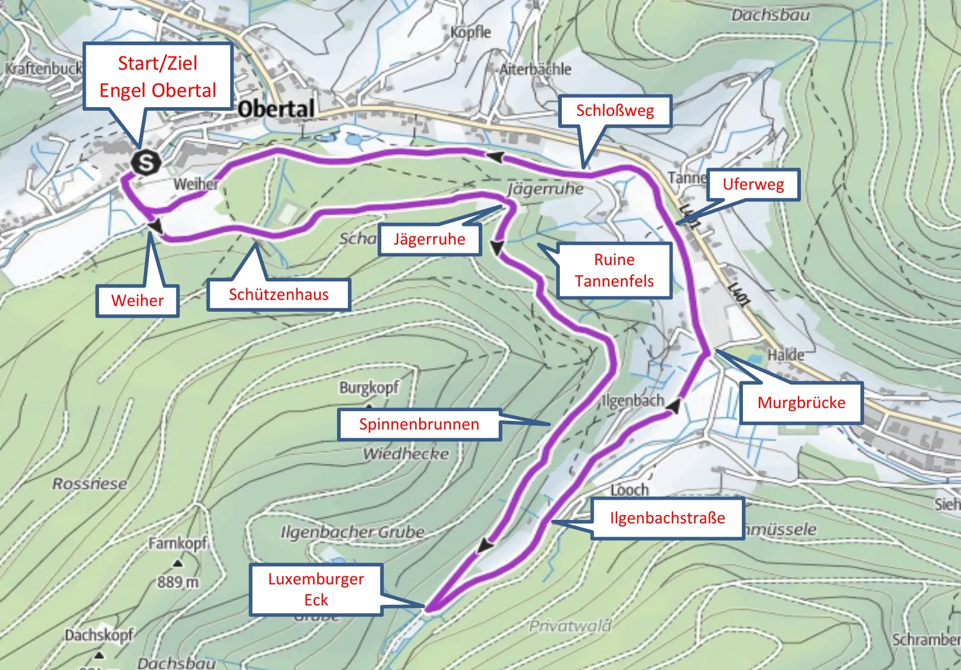
Obertal and the Ilgenbach valley, the panorama loop

6.6 kilometres · moderate · 119 metres of ascent · about 1 hour 10 minutes

The Weiherweg climbs to the Schützenhaus in the woods, then the route runs fairly level along the yellow diamond waymarks to the sports ground and the Jägerruhe. Past the Tannenfels ruins and the Försterstein you reach the Spinnenbrunnen and, a little later, the Luxemburger Eck on the Ilgenbach.

Here you leave the network of hiking trails with a sharp left turn and follow the stream downhill into the Ilgenbachstraße. The way back runs along the Murg via the Schloss, Schlossweg, Uferweg and Scharrain signposts to the Weiher and from there to the Engel.

Laufstreckenkarte der Runde Obertal–Ilgenbachtal ab Engel Obertal mit Route über Schützenhaus, Jägerruhe, Ruine Tannenfels und Spinnenbrunnen.

The loop through Obertal and the Ilgenbach valley links the high path with the banks of the Murg.
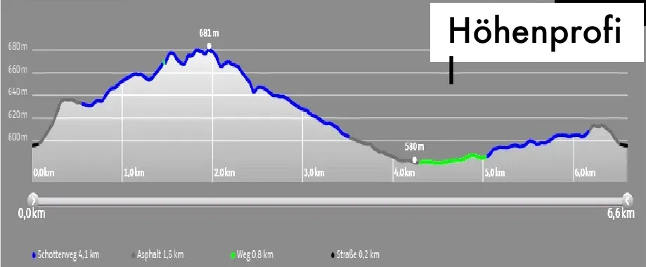
Höhenprofil der Laufstrecke Obertal–Ilgenbachtal: 6,6 km, 119 Höhenmeter.

Elevation profile of the Ilgenbach valley loop, 119 metres of ascent.
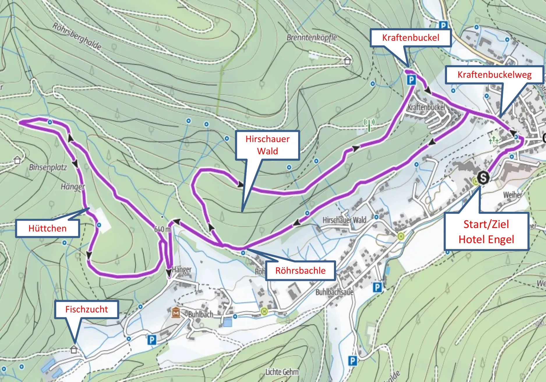
Into the Buhlbach valley, the demanding forest loop

8.2 kilometres · difficult · 226 metres of ascent · about 1 hour 30 minutes

The king of the running loops. Opposite the Medical Resort, a steep footpath climbs to the Kraftenbuckelweg, past the church and along the edge of the woods towards the Hirschauer Wald. A narrow forest path with a slight incline takes you towards the Hänger, then the route continues in hairpin bends, past a small hut, until the fish farm in the Buhlbach valley comes into view below.

Above the fish farm, the route runs back along the edge of the woods to the Hänger, with wide views along the way. Take the narrow forest path once more and return to the Hotel Engel via the Kraftenbuckelweg.

Laufstreckenkarte der Runde ins Buhlbachtal ab Engel Obertal mit Route über Kraftenbuckelweg, Hirschauer Wald, Hänger und Fischzucht.

The big Buhlbach valley loop, 8.2 kilometres on forest paths and high tracks.
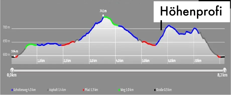
Höhenprofil der Laufstrecke ins Buhlbachtal: 8,2 km, 226 Höhenmeter.

Elevation profile of the Buhlbach valley running loop, 226 metres of ascent, the most demanding of the four routes.

Good to know

All four routes are just as good for walking, in which case the times roughly double. The surfaces are mostly gravel and tarmac with short stretches of path, so ordinary running shoes are all you need.

After your run, Wolke 7 is waiting. Head for the sauna or the brine pool, or take a dip in the natural swimming lake. Recovery is included, right here at the hotel.

Aktiv

Further reading

Related articles

  • Tennisspieler beim Aufschlag auf einem Sandplatz, von oben fotografiert, mit langen Schatten auf dem Platz.

    Engel Obertal

    September 29, 2026

    Tennis at Engel Obertal

    Three clay courts in the Buhlbach valley, around 15 minutes on foot from the hotel. Guests of the Engel can play at the Tennisgemeinschaft Obertal, the local tennis club.
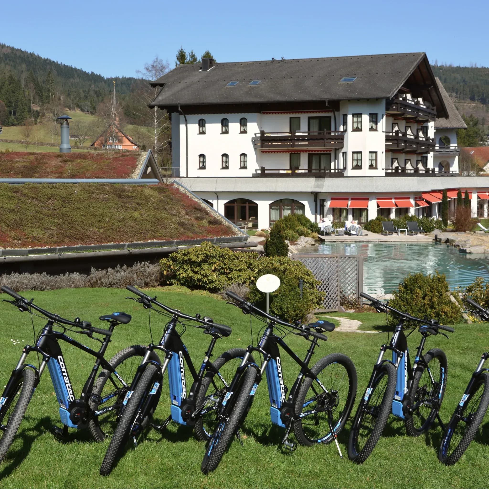
  • Reihe blauer E-Bikes auf der Wiese vor dem Hotel mit Naturpool.

    Engel Obertal

    August 28, 2026

    Cycle routes from Engel Obertal

    Four routes, from a panoramic loop to the Tour de Murg. And the hotel's own e-bike fleet for a tailwind.
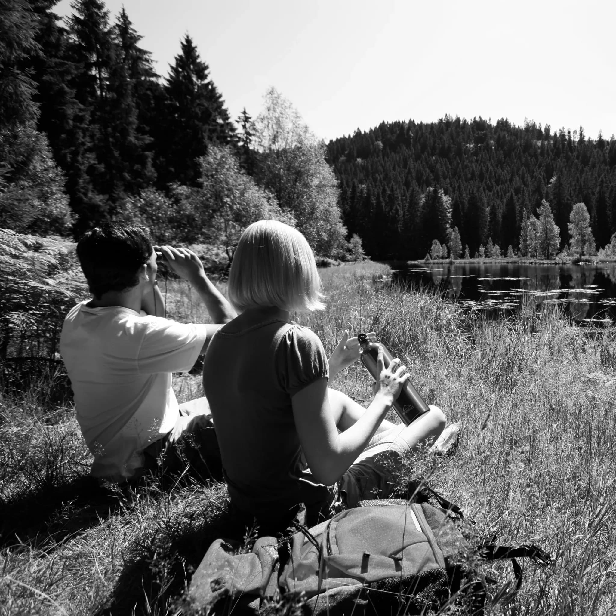
  • Zwei Wanderer machen Rast am Ufer eines von Wald umschlossenen Sees, Schwarzweiß.

    Engel Obertal

    August 21, 2026

    Long hikes into the Rotmurg valley, to the Rechtmurg and up to the Buhlbachsee

    Three circular routes of over ten kilometres for anyone who wants a full day's walking. All the way to a dark tarn.

  • Tennisspieler beim Aufschlag auf einem Sandplatz, von oben fotografiert, mit langen Schatten auf dem Platz.

    Engel Obertal

    September 29, 2026

    Tennis at Engel Obertal

    Three clay courts in the Buhlbach valley, around 15 minutes on foot from the hotel. Guests of the Engel can play at the Tennisgemeinschaft Obertal, the local tennis club.

  • Reihe blauer E-Bikes auf der Wiese vor dem Hotel mit Naturpool.

    Engel Obertal

    August 28, 2026

    Cycle routes from Engel Obertal

    Four routes, from a panoramic loop to the Tour de Murg. And the hotel's own e-bike fleet for a tailwind.

  • Zwei Wanderer machen Rast am Ufer eines von Wald umschlossenen Sees, Schwarzweiß.

    Engel Obertal

    August 21, 2026

    Long hikes into the Rotmurg valley, to the Rechtmurg and up to the Buhlbachsee

    Three circular routes of over ten kilometres for anyone who wants a full day's walking. All the way to a dark tarn.

  • Tennisspieler beim Aufschlag auf einem Sandplatz, von oben fotografiert, mit langen Schatten auf dem Platz.

    Engel Obertal

    September 29, 2026

    Tennis at Engel Obertal

    Three clay courts in the Buhlbach valley, around 15 minutes on foot from the hotel. Guests of the Engel can play at the Tennisgemeinschaft Obertal, the local tennis club.

  • Reihe blauer E-Bikes auf der Wiese vor dem Hotel mit Naturpool.

    Engel Obertal

    August 28, 2026

    Cycle routes from Engel Obertal

    Four routes, from a panoramic loop to the Tour de Murg. And the hotel's own e-bike fleet for a tailwind.

  • Zwei Wanderer machen Rast am Ufer eines von Wald umschlossenen Sees, Schwarzweiß.

    Engel Obertal

    August 21, 2026

    Long hikes into the Rotmurg valley, to the Rechtmurg and up to the Buhlbachsee

    Three circular routes of over ten kilometres for anyone who wants a full day's walking. All the way to a dark tarn.