August 21, 2026

7 minutes read

7 minutes read

By

Long hikes into the Rotmurg valley, to the Rechtmurg and up to the Buhlbachsee

Three circular routes of over ten kilometres for anyone who wants a full day's walking. All the way to a dark tarn.

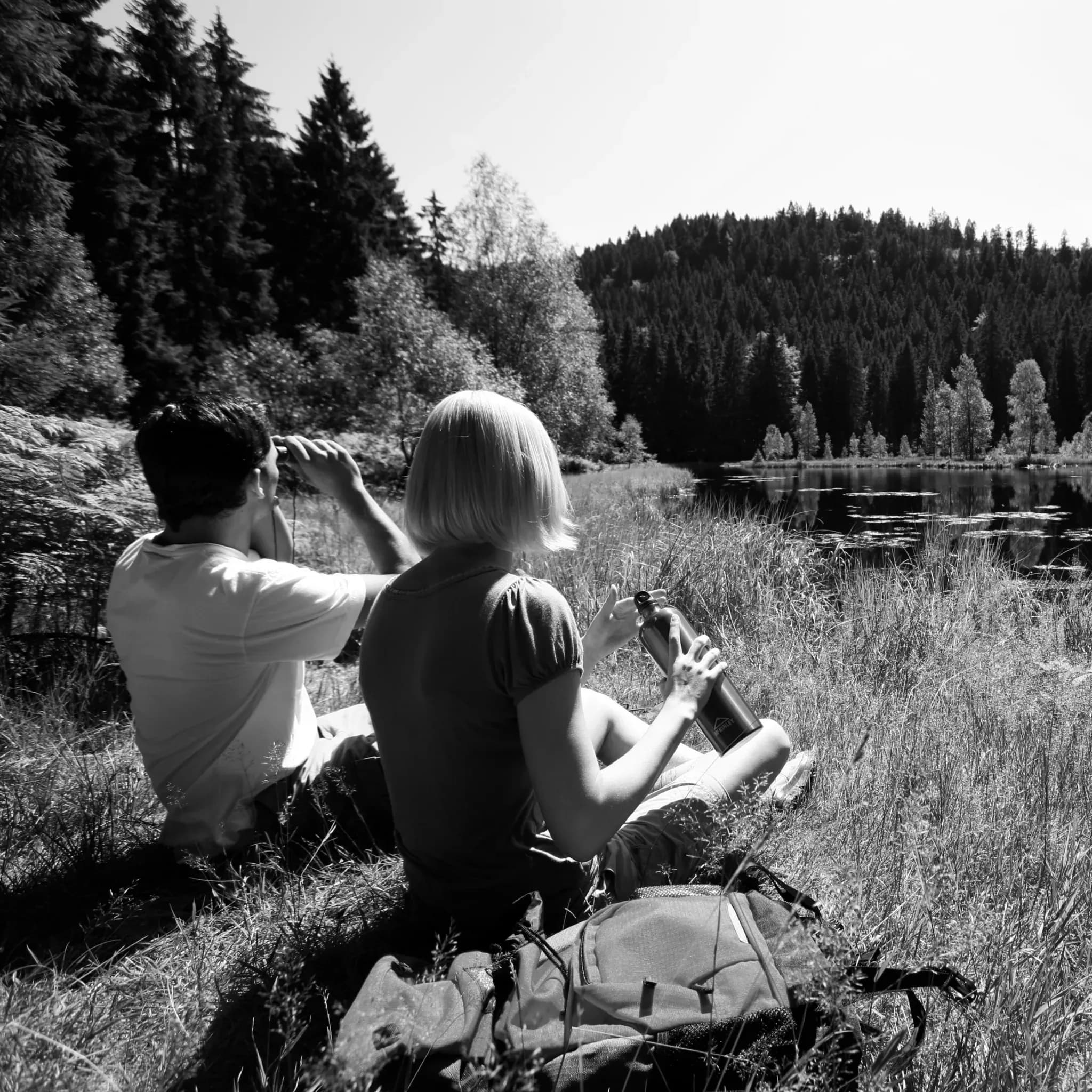
Zwei Wanderer machen Rast am Ufer eines von Wald umschlossenen Sees, Schwarzweiß.

Some days are made for walking. If you want to lace up your boots in the morning and not be back until early afternoon, three long circular routes lead from the Engel's front door into the quieter corners of the Rechtmurg valley. Along wild streams, through secluded side valleys and up to one of the dark tarns of the northern Black Forest.

All three routes come in at a good ten kilometres, take around three hours of actual walking, and repay you with landscapes that stay hidden on the shorter circuits.

Into the Rotmurg valley, where stones tell their story

10.4 kilometres · moderate · 155 metres of ascent · about 3 hours

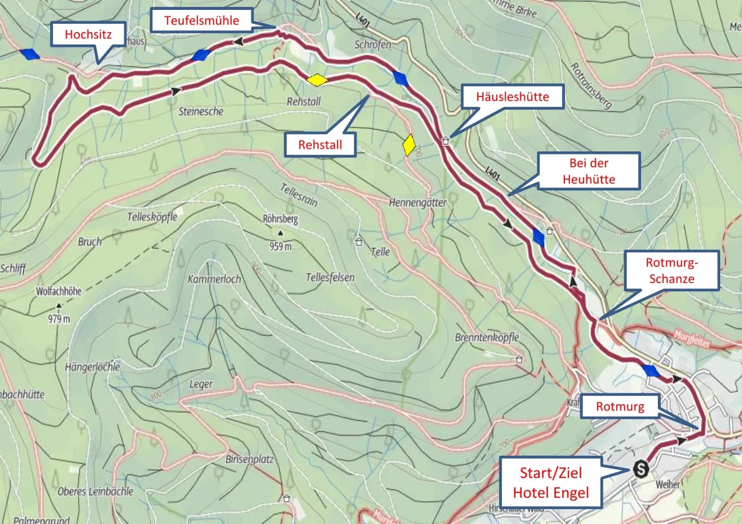
The geological trail "Steine erzählen Geschichte" (stones tell history) starts at the Rotmurg signpost next to the Murg-Café. Follow its blue diamond waymarks up the valley, past the Rotmurg-Schanze, the Heuhütte and the Häusleshütte as far as the Teufelsmühle. For almost the whole way, the path keeps company with the waters of the Rotmurg.

From the Teufelsmühle, an unmarked forest track leads uphill and out along the valley to the Rehstall. Then follow the yellow diamond towards the Häusleshütte and back above the Rotmurg to the Rotmurg-Schanze. Along the riverbank you come back into the centre of Obertal, and from there it is only a stone's throw to the Engel.

Wanderkarte der Tour ins Rotmurgtal ab Hotel Engel Obertal mit Route über Rotmurg-Schanze, Häusleshütte, Teufelsmühle und Rehstall.

The Rotmurg valley route follows the geological trail as far as the Teufelsmühle.
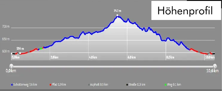
Höhenprofil der Tour ins Rotmurgtal: 10,4 km, 155 Höhenmeter, höchster Punkt 747 m.

Elevation profile of the Rotmurg valley route, a steady climb to 747 metres, then back out along the valley.
Tour de Rechtmurg, the high-level circuit above the valley

10.6 kilometres · moderate · 242 metres of ascent · about 3 hours 15 minutes

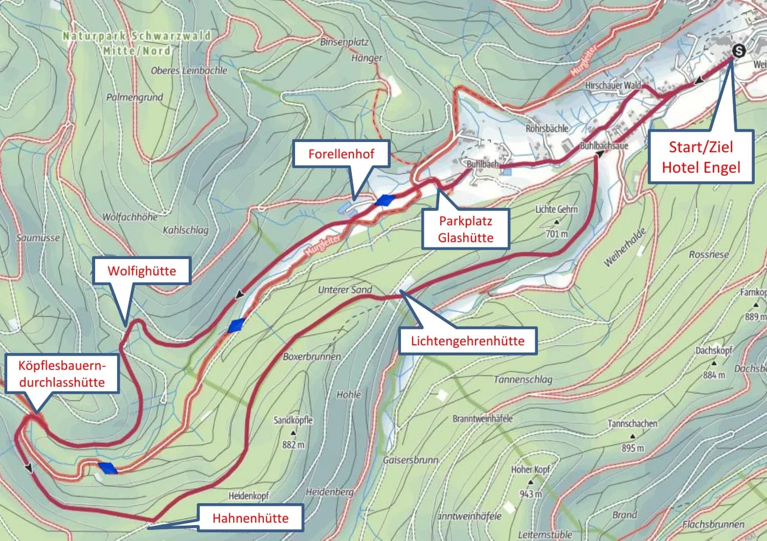
From the hotel, turn right into the Buhlbach valley and walk as far as the Glashütte Buhlbach and on to the Forellenhof. From there the path climbs in three stages. First to the Wolfighütte, then to the Köpflesbauerndurchlasshütte, where a small bridge takes you across the Rechtmurg, and finally up to the Hahnenhütte at a good 837 metres.

The way back is the reward. For around two kilometres you descend with wide views into the Rechtmurg valley, down to the Lichtengehrenhütte and on to the edge of Buhlbach. The road through the residential area brings you back to the Hotel Engel.

Wanderkarte der Tour de Rechtmurg ab Hotel Engel Obertal mit Route über Forellenhof, Wolfighütte, Köpflesbauerndurchlasshütte und Hahnenhütte.

The Tour de Rechtmurg climbs via three huts up to the Hahnenhütte.
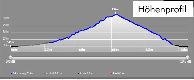
Höhenprofil der Tour de Rechtmurg: 10,6 km, 242 Höhenmeter, höchster Punkt 837 m.

Elevation profile of the Tour de Rechtmurg, an even climb to 837 metres.

“The Buhlbachsee is one of the dark eyes of the northern Black Forest, a tarn the Ice Age carved into the hillside.”
To the Buhlbachsee, the dark eye of the northern Black Forest

10.6 kilometres · moderate · 271 metres of ascent · about 3 hours 15 minutes

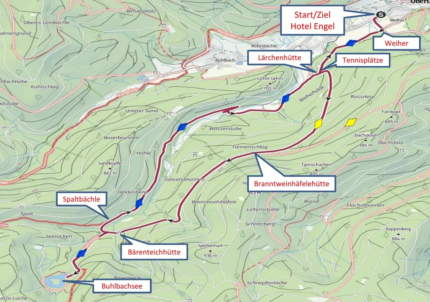
From the Weiher, follow the blue diamond to the tennis courts and then the yellow diamond steadily uphill to the Branntweinhäfelehütte. The path continues to the Bärenteichhütte, where a wooden sign reading "Buhlbachsee 600m" points the way for the final stretch. Keeping to the blue diamond and the Genießer-Tour, you arrive at the lake.

The still tarn with its floating bog island is the turning point of the route and a place to linger. You return along the Genießer-Tour via the Spaltbächle signpost to the Lärchenhütte, then at an easy pace past the tennis courts and along the Weiherhaldenweg to the hotel.

Wanderkarte der Tour zum Buhlbachsee ab Hotel Engel Obertal mit Route über Branntweinhäfelehütte, Bärenteichhütte und Spaltbächle.

The route to the Buhlbachsee, up via the Branntweinhäfelehütte, back via the Spaltbächle.
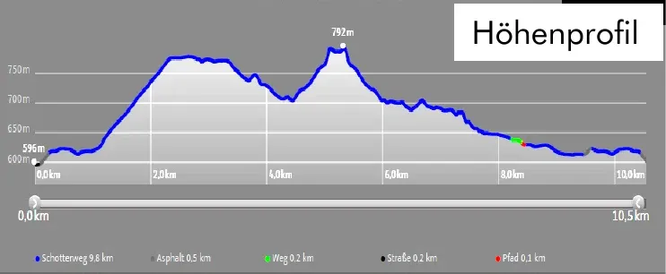
Höhenprofil der Wanderung zum Buhlbachsee: 10,6 km, 271 Höhenmeter, höchster Punkt 792 m.

Elevation profile of the Buhlbachsee route, 271 metres of ascent, highest point 792 metres.

Good to know

An early start pays off on the long routes, leaving time for proper breaks at the huts and viewpoints. Rucksacks and walking poles are available free of charge at reception, and the kitchen will happily pack you a lunch to take with you.

All three routes follow the waymarks of the Baiersbronner Wanderhimmel. Only short sections are unmarked, and these are described on the maps. In unsettled weather, the Nationalparkregion app helps with a topographic map and up-to-date information.

Aktiv

Further reading

Related articles

  • Tennisspieler beim Aufschlag auf einem Sandplatz, von oben fotografiert, mit langen Schatten auf dem Platz.

    Engel Obertal

    September 29, 2026

    Tennis at Engel Obertal

    Three clay courts in the Buhlbach valley, around 15 minutes on foot from the hotel. Guests of the Engel can play at the Tennisgemeinschaft Obertal, the local tennis club.
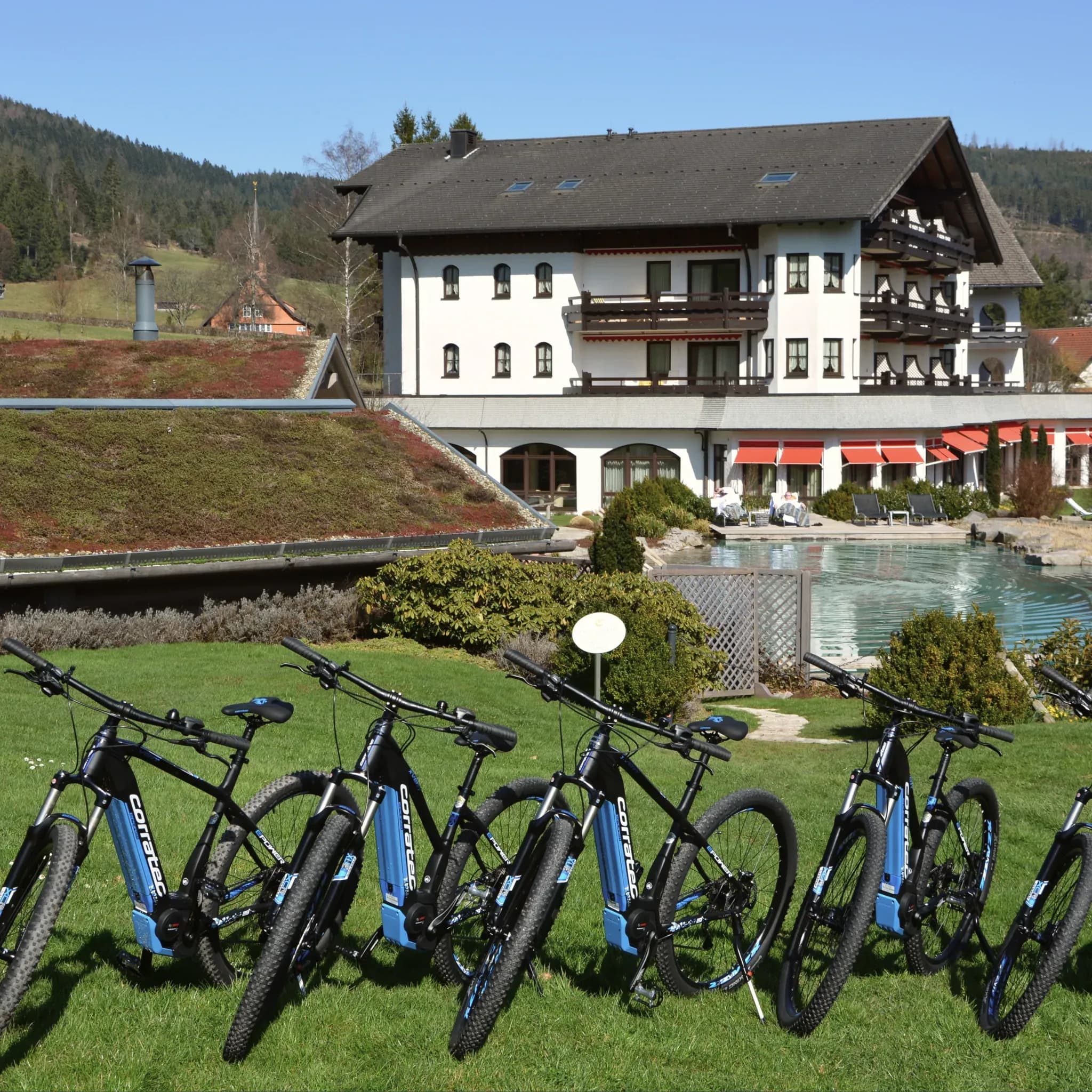
  • Reihe blauer E-Bikes auf der Wiese vor dem Hotel mit Naturpool.

    Engel Obertal

    August 28, 2026

    Cycle routes from Engel Obertal

    Four routes, from a panoramic loop to the Tour de Murg. And the hotel's own e-bike fleet for a tailwind.
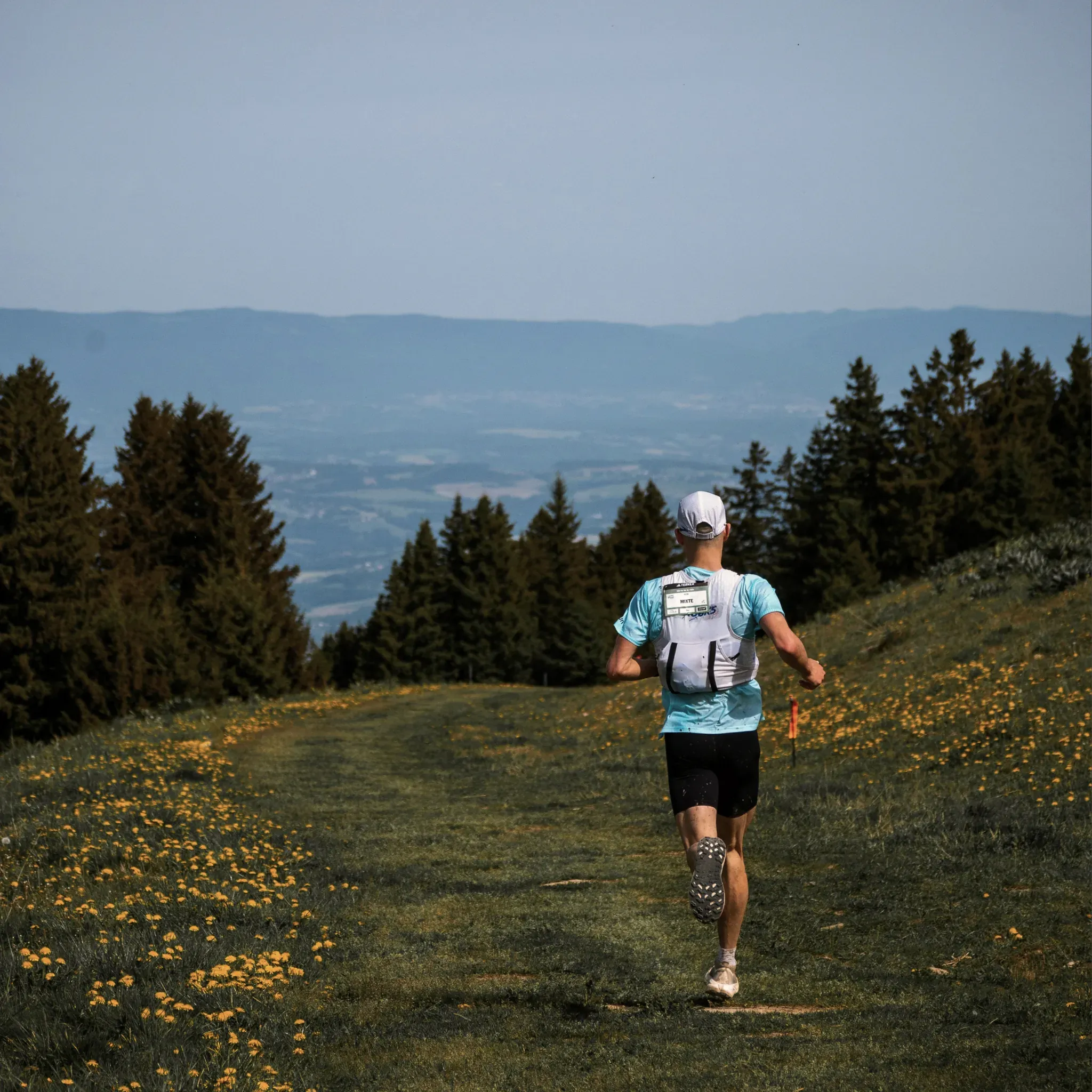
  • Läufer mit Trinkweste joggt über eine blühende Bergwiese am Waldrand.

    Engel Obertal

    August 25, 2026

    Running routes at Engel Obertal

    Four loops between 2.7 and 8.2 kilometres. An easy morning run at one end, a demanding forest loop at the other.

  • Tennisspieler beim Aufschlag auf einem Sandplatz, von oben fotografiert, mit langen Schatten auf dem Platz.

    Engel Obertal

    September 29, 2026

    Tennis at Engel Obertal

    Three clay courts in the Buhlbach valley, around 15 minutes on foot from the hotel. Guests of the Engel can play at the Tennisgemeinschaft Obertal, the local tennis club.

  • Reihe blauer E-Bikes auf der Wiese vor dem Hotel mit Naturpool.

    Engel Obertal

    August 28, 2026

    Cycle routes from Engel Obertal

    Four routes, from a panoramic loop to the Tour de Murg. And the hotel's own e-bike fleet for a tailwind.

  • Läufer mit Trinkweste joggt über eine blühende Bergwiese am Waldrand.

    Engel Obertal

    August 25, 2026

    Running routes at Engel Obertal

    Four loops between 2.7 and 8.2 kilometres. An easy morning run at one end, a demanding forest loop at the other.

  • Tennisspieler beim Aufschlag auf einem Sandplatz, von oben fotografiert, mit langen Schatten auf dem Platz.

    Engel Obertal

    September 29, 2026

    Tennis at Engel Obertal

    Three clay courts in the Buhlbach valley, around 15 minutes on foot from the hotel. Guests of the Engel can play at the Tennisgemeinschaft Obertal, the local tennis club.

  • Reihe blauer E-Bikes auf der Wiese vor dem Hotel mit Naturpool.

    Engel Obertal

    August 28, 2026

    Cycle routes from Engel Obertal

    Four routes, from a panoramic loop to the Tour de Murg. And the hotel's own e-bike fleet for a tailwind.

  • Läufer mit Trinkweste joggt über eine blühende Bergwiese am Waldrand.

    Engel Obertal

    August 25, 2026

    Running routes at Engel Obertal

    Four loops between 2.7 and 8.2 kilometres. An easy morning run at one end, a demanding forest loop at the other.