August 18, 2026

7 minutes read

7 minutes read

By

Scenic half-day hikes around Obertal

Four moderate circular routes to the finest viewpoints. Wolkenhütte, Around Obertal, the Buhlbach valley and the Walterhütte.

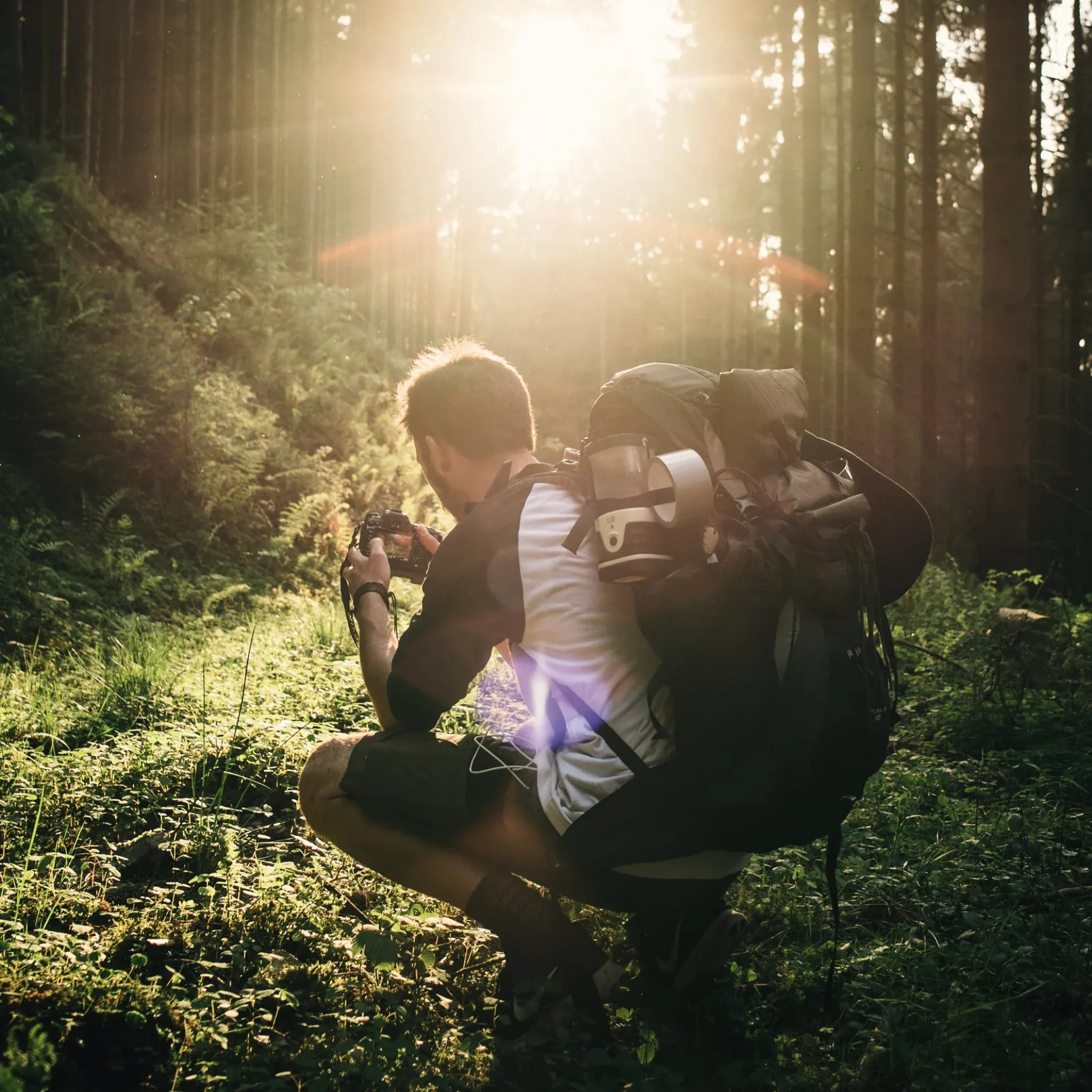
Wanderer mit großem Rucksack geht durch einen Wald im Gegenlicht.

Two to two and a half hours on the move, a few hundred metres of climbing, and at the top a bench with a view. The half-day hike is the ideal format for a day of your holiday that should still leave room for breakfast and the sauna.

Four moderate circular routes of between 6.7 and 8.3 kilometres lead from the door of the Engel to the finest viewpoints above Obertal. Each comes with a map and elevation profile, and none of them needs a drive to the start.

Up to the Wolkenhütte, the classic with a view of the valley

6.7 kilometres · moderate · 225 metres of ascent · about 2 hours 15 minutes

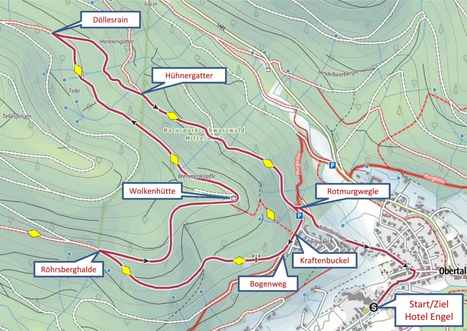
From the hotel, the route climbs opposite the sanatorium to the Protestant church and follows the Kraftenbuckelweg to the Rotmurgwegle signpost. From there, follow the signs towards Kraftenbuckel and Bogenweg, then the yellow diamond along the lovely forest path to the Röhrsberghalde.

A little later you reach the Wolkenhütte, and with it a wide view over Obertal and the surrounding ridges, on a clear day as far as Baiersbronn. The route continues via Döllesrain, Hühnergatter and Rotmurgwegle back to the Kraftenbuckel and down to the hotel.

Wanderkarte der Tour zur Wolkenhütte ab Hotel Engel Obertal mit Route über Kraftenbuckel, Röhrsberghalde, Döllesrain und Hühnergatter.

The Wolkenhütte circuit, up via the Bogenweg, back via Döllesrain.
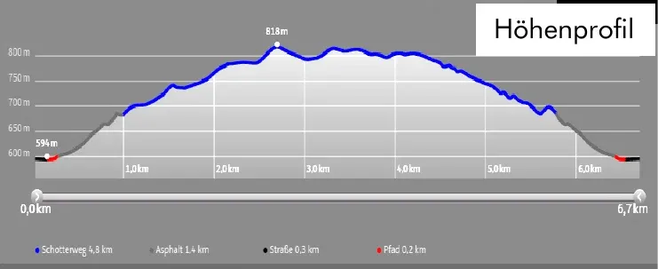
Höhenprofil der Wanderung zur Wolkenhütte: 6,7 km, 225 Höhenmeter, höchster Punkt 818 m.

Elevation profile of the Wolkenhütte route, 225 metres of ascent up to 818 metres.
Around Obertal, a full circuit of the village

7.0 kilometres · moderate · 119 metres of ascent · about 2 hours

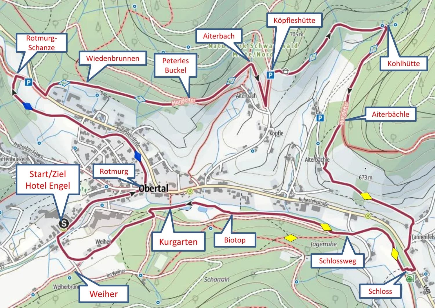
This circuit shows Obertal from every side. The trail begins at the Rotmurg signpost and follows the blue diamond to the Rotmurg-Schanze, then crosses the Ruhesteinstraße to the other side of the valley. Following the Murgleiter, you climb gently past the Wiedenbrunnen to the Peterles Buckel and on to the Köpfleshütte.

Via the Kohlhütte and Aiterbächle, the path joins a beautiful meadow track and drops down to the road. After the bridge at the Schloss signpost, follow the yellow diamond via Schlossweg, Uferweg and the biotope through the Kurpark and past the Weiher back to the Engel.

Wanderkarte der Rundtour um Obertal ab Hotel Engel mit Route über Rotmurg-Schanze, Wiedenbrunnen, Köpfleshütte, Kohlhütte und Schloss.

The circuit crosses the valley twice and takes in both hillsides.
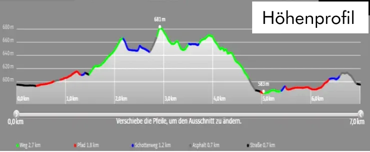
Höhenprofil der Rundwanderung um Obertal: 7,0 km, 119 Höhenmeter.

Elevation profile of the Obertal circuit, 119 metres of ascent, evenly spread.

“A bench at the top, the valley below, forest in between. Half-day hikes are the ideal holiday format.”
Into the Buhlbach valley, quiet paths beside the stream

8.0 kilometres · moderate · 161 metres of ascent · about 2 hours 15 minutes

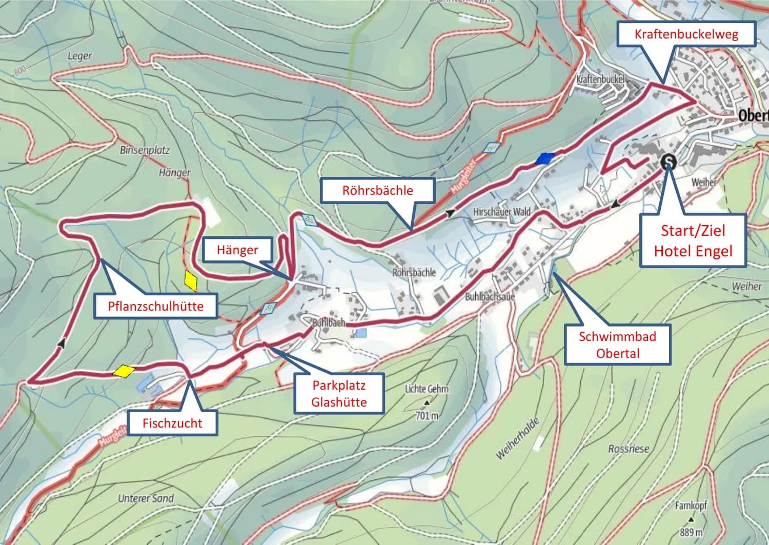
From the hotel, turn right into the Buhlbach valley and stroll along the tarmac path to the Glashütte car park and on to the fish farm. There the route turns off into the forest track and follows the yellow diamond past the Pflanzschulhütte to the Hänger signpost.

The way back follows the Murgleiter signs along an unsurfaced path to the Röhrsbächle, then keeps straight on along the blue diamond to the Kraftenbuckel. From there the path passes above the Protestant church and drops down to the Engel.

Wanderkarte der Tour ins Buhlbachtal ab Hotel Engel Obertal mit Route über Parkplatz Glashütte, Fischzucht, Pflanzschulhütte und Hänger.

The Buhlbach valley route, up the valley via the fish farm, back along the high path.
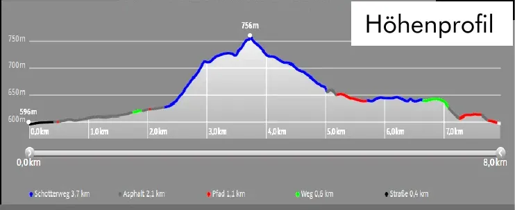
Höhenprofil der Wanderung ins Buhlbachtal: 8,0 km, 161 Höhenmeter, höchster Punkt 756 m.

Elevation profile of the Buhlbach valley hike, highest point 756 metres.
Genussplatz at the Walterhütte, a view with a sky lounger

8.3 kilometres · moderate · 254 metres of ascent · about 2 hours 30 minutes

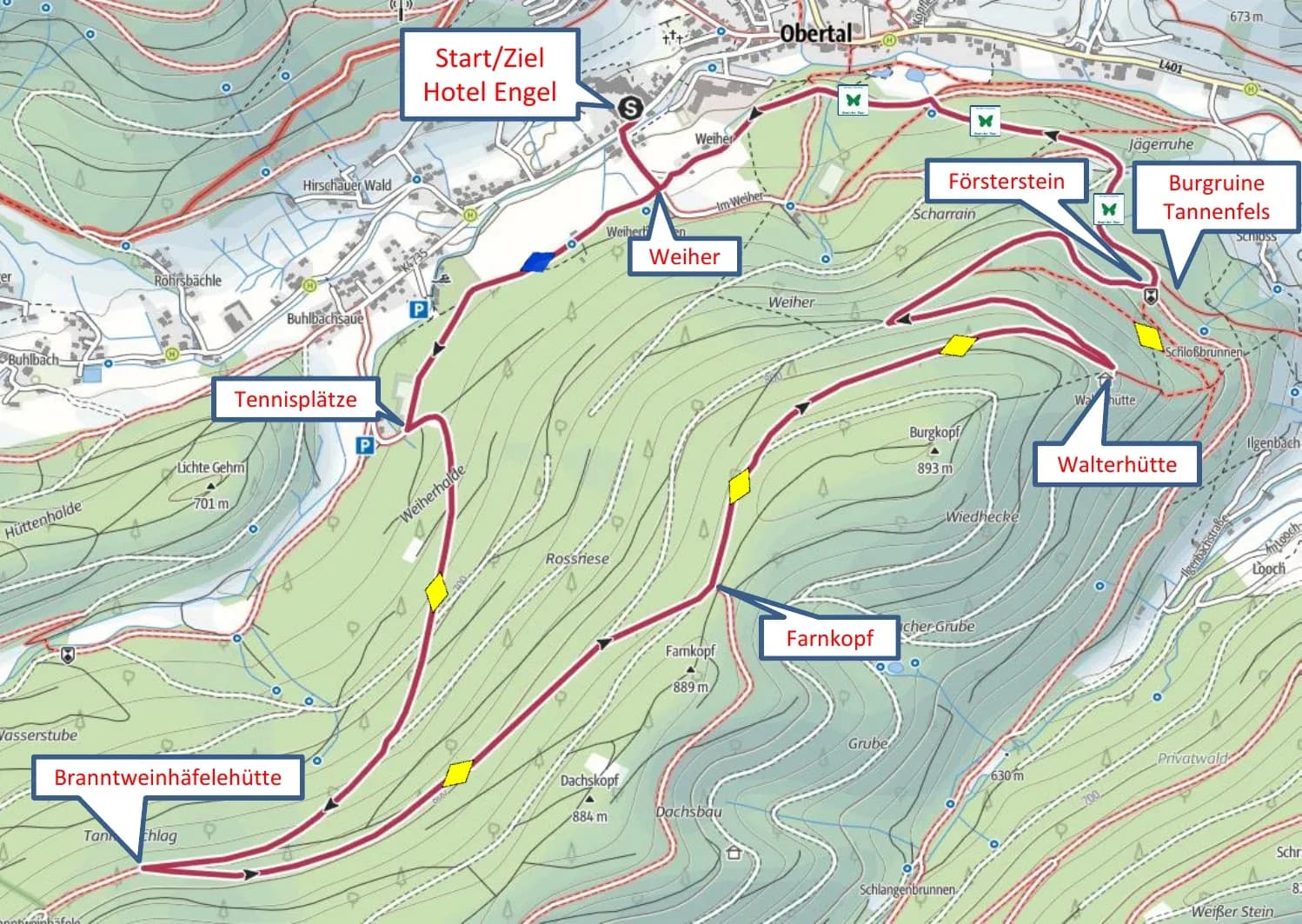
The most demanding of the four circuits rewards you with the finest spot for a rest. From the Weiher, follow the blue diamond past the tennis courts and then the yellow diamond steadily uphill to the Branntweinhäfelehütte. Across the Farnkopf, a wide plateau with views over Obertal and Buhlbach, you reach the Walterhütte in its rustic setting.

This is the place for a break. The view stretches over Mitteltal to Baiersbronn, and a sky lounger waits on the slope. For the return, the path drops to the Försterstein and follows the Genießer-Tour past the Tannenfels ruins, via Jägerruhe and Scharrain, to the hotel.

Wanderkarte der Tour zum Genussplatz an der Walterhütte ab Hotel Engel Obertal mit Route über Branntweinhäfelehütte, Farnkopf und Ruine Tannenfels.

To the Genussplatz at the Walterhütte, via the Branntweinhäfelehütte and the Farnkopf.
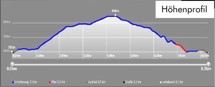
Höhenprofil der Wanderung zur Walterhütte: 8,3 km, 254 Höhenmeter, höchster Punkt 850 m.

Elevation profile of the Walterhütte route, 254 metres of ascent up to 850 metres.

Good to know

All four routes follow the diamond waymarks and signpost boards of the Baiersbronner Wanderhimmel. Reception lends out rucksacks and walking poles free of charge, and the Nationalparkregion app puts the maps on your smartphone.

The huts along the way are rest stops, not refreshment stops. A small packed lunch from the hotel makes the break at the Walterhütte or the Wolkenhütte perfect.

Aktiv

Further reading

Related articles

  • Tennisspieler beim Aufschlag auf einem Sandplatz, von oben fotografiert, mit langen Schatten auf dem Platz.

    Engel Obertal

    September 29, 2026

    Tennis at Engel Obertal

    Three clay courts in the Buhlbach valley, around 15 minutes on foot from the hotel. Guests of the Engel can play at the Tennisgemeinschaft Obertal, the local tennis club.
  • Reihe blauer E-Bikes auf der Wiese vor dem Hotel mit Naturpool.

    Engel Obertal

    August 28, 2026

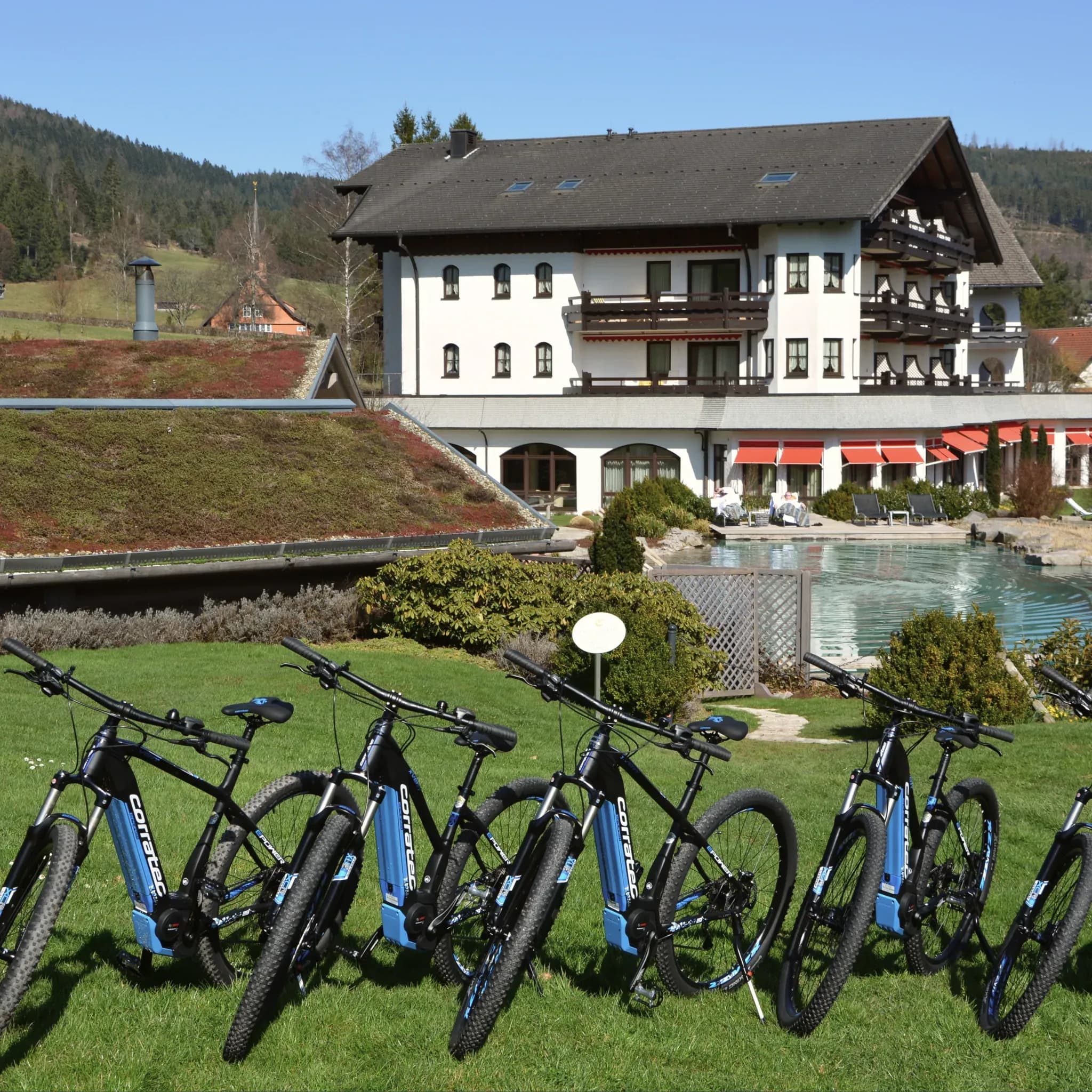
    Cycle routes from Engel Obertal

    Four routes, from a panoramic loop to the Tour de Murg. And the hotel's own e-bike fleet for a tailwind.
  • Läufer mit Trinkweste joggt über eine blühende Bergwiese am Waldrand.

    Engel Obertal

    August 25, 2026

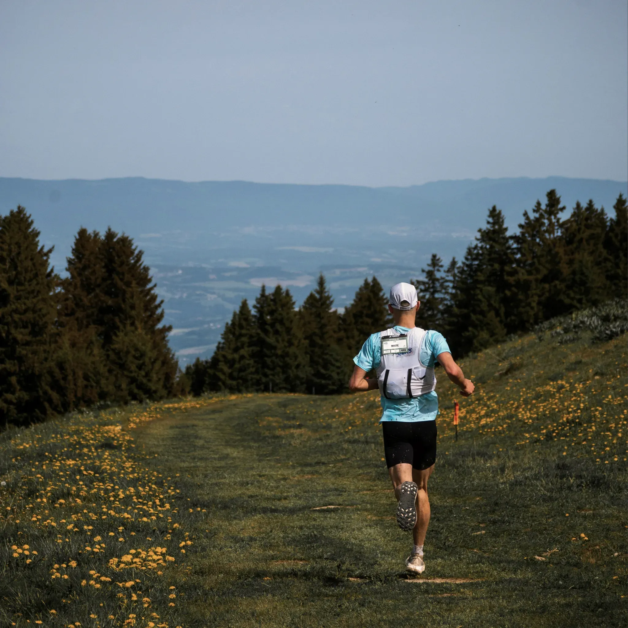
    Running routes at Engel Obertal

    Four loops between 2.7 and 8.2 kilometres. An easy morning run at one end, a demanding forest loop at the other.

  • Tennisspieler beim Aufschlag auf einem Sandplatz, von oben fotografiert, mit langen Schatten auf dem Platz.

    Engel Obertal

    September 29, 2026

    Tennis at Engel Obertal

    Three clay courts in the Buhlbach valley, around 15 minutes on foot from the hotel. Guests of the Engel can play at the Tennisgemeinschaft Obertal, the local tennis club.

  • Reihe blauer E-Bikes auf der Wiese vor dem Hotel mit Naturpool.

    Engel Obertal

    August 28, 2026

    Cycle routes from Engel Obertal

    Four routes, from a panoramic loop to the Tour de Murg. And the hotel's own e-bike fleet for a tailwind.

  • Läufer mit Trinkweste joggt über eine blühende Bergwiese am Waldrand.

    Engel Obertal

    August 25, 2026

    Running routes at Engel Obertal

    Four loops between 2.7 and 8.2 kilometres. An easy morning run at one end, a demanding forest loop at the other.

  • Tennisspieler beim Aufschlag auf einem Sandplatz, von oben fotografiert, mit langen Schatten auf dem Platz.

    Engel Obertal

    September 29, 2026

    Tennis at Engel Obertal

    Three clay courts in the Buhlbach valley, around 15 minutes on foot from the hotel. Guests of the Engel can play at the Tennisgemeinschaft Obertal, the local tennis club.

  • Reihe blauer E-Bikes auf der Wiese vor dem Hotel mit Naturpool.

    Engel Obertal

    August 28, 2026

    Cycle routes from Engel Obertal

    Four routes, from a panoramic loop to the Tour de Murg. And the hotel's own e-bike fleet for a tailwind.

  • Läufer mit Trinkweste joggt über eine blühende Bergwiese am Waldrand.

    Engel Obertal

    August 25, 2026

    Running routes at Engel Obertal

    Four loops between 2.7 and 8.2 kilometres. An easy morning run at one end, a demanding forest loop at the other.